

China’s state-owned Standard Map Service has presented a set of geographic maps for 2023, which for the first time shows part of Russia’s territory as part of China. We are talking about the Big Ussuri Island on the Amur River.
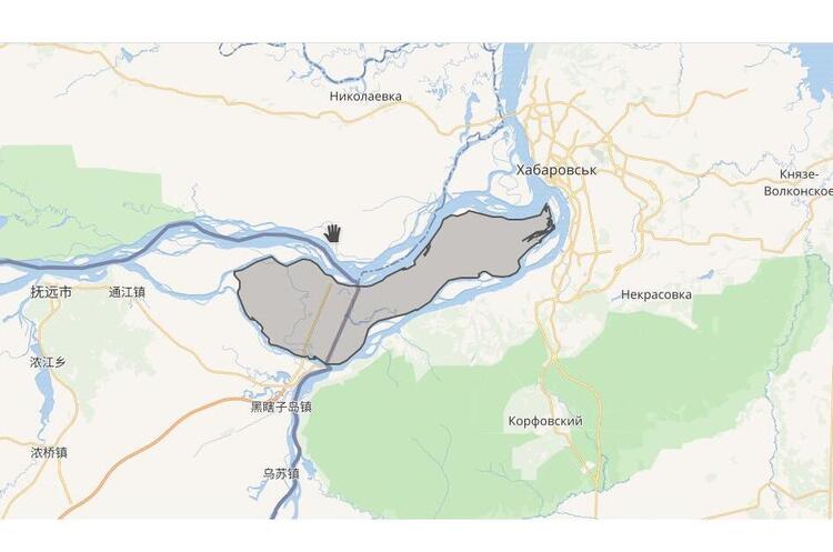
According to a 2008 agreement between Russia and China, the island was divided between the two countries. A new official map of China marks the entire island as the easternmost point of Chinese territory.
The official map set will be used in various media materials, including news, books, and promotional materials. Maps also serve as basic reference information.
The Big Ussuri Island covers an area of 327 to 350 square meters. kilometers, depending on the water level in the river. Since the beginning of the nineteenth century, Russia and China have been fighting for control of the island, but in the 1920s and 1930s, the island was “taken under guard” by Soviet troops.
After the collapse of the Soviet Union, the island remained under Russian jurisdiction. China has shown a special interest in this territory, denying its status since 1964.
In 2008, Russia handed over the western part of the Great Ussuri Island and other territories to China against the backdrop of “Moscow’s long-term interests in stable relations between the two countries.”
Big Ussuri Island is a river island located at the confluence of the Ussuri and Amur rivers, in close proximity to the Russian city of Khabarovsk. The island is located next to the Chinese island of Yinlong (Tarabarov) and several dozen other small islets.
In addition to the Great Ussuri Island, China has marked the Indian state of Arunachal Pradesh and the Aksai Chin border region as its territory. The Indian Foreign Ministry has already protested to Beijing.