


DeepStateMap: map of the war in Ukraine with real-time updates
Ukraine has launched the DeepStateMap website with a real-time map of the war. There are red, blue, and black areas on the map. In the first case, it is a temporarily occupied territory by the racists since the beginning of the full-scale invasion on February 24. In the second – places where the Armed Forces knocked out the occupier. The territories occupied by Russia in 2014 (Crimea, part of Donetsk and Luhansk oblasts) are marked in black.
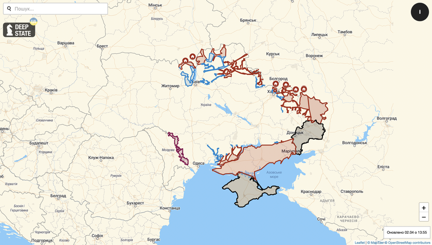
Of course, the map is for information only. Never use it for safe routes. For green corridors, follow the official information of the local authorities.