


How artificial intelligence will help in agriculture
Brazilian scientists have trained artificial intelligence to analyze satellite images that show areas where crop production and livestock breeding are effectively combined. The latter concept is considered revolutionary and has the potential to ensure the sustainable development of the agricultural industry. But scientists want to know how effective this idea really is.
Integrated system of agricultural activities
Brazilian scientists have published an interesting paper in the field of satellite agricultural monitoring. The devices in orbit have long been used to assess the condition of agricultural land. However, in the new study, they were used to monitor the areas where the system of crop-livestock integration is being implemented.
The crop-livestock integration (CLI) system is a promising new technology that has the potential to change agriculture, although the ideas behind it are actually extremely old. They consist of a complex alternation of growing crops and raising livestock, mainly cows and pigs.
The fact is that growing soybeans, corn, and other similar crops is much more profitable than livestock farming, provided that yields are high. However, this harvest is in fact extremely unstable, in part because of the plants themselves, which severely deplete the land.
On the other hand, livestock farming still needs all of the above. In addition, replacing sowing with grazing for one season helps to reclaim the land. Sophisticated modern mathematical models have been invented for all this, and they have proven themselves well in the experimental areas.
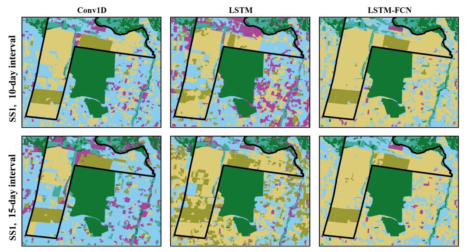
Artificial intelligence and computer images
However, we still need to understand how the new technology performs in mass use and in different conditions. The number of agricultural producers trying it is growing every year, and it is almost impossible to observe their results on Earth.
And this is where satellites come in. They have been used to monitor the condition of the fields for years. The only problem is to find among the large number of images exactly those plots that are used under the crop-livestock integration program.
It would be impossible to do this manually, but there is a solution: neural networks. So the Brazilian scientists only had to train the artificial intelligence on the ready-made decoded images. Eventually, he learned not only to distinguish the necessary areas, but also to assess their condition.
The study was conducted in the states of São Paulo and Mato Grosso. The object-based image analysis was performed at 10 and 15-day intervals in four stages: obtaining CLI data via Planetscope, a group of satellites that capture high-resolution images of the Earth’s surface, showing changes in areas over time; training algorithms to recognize patterns associated with CLI; displaying CLI areas; and evaluating the model’s accuracy by comparing the automatic results with previous data.