

Google Maps accidentally revealed the location of a secret US underwater drone
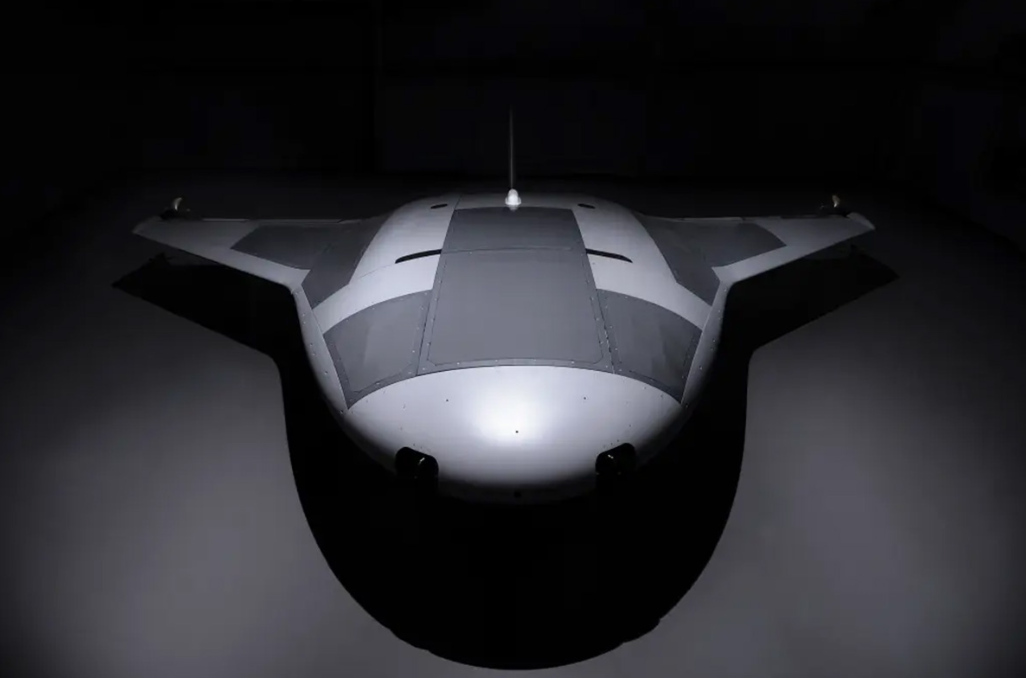
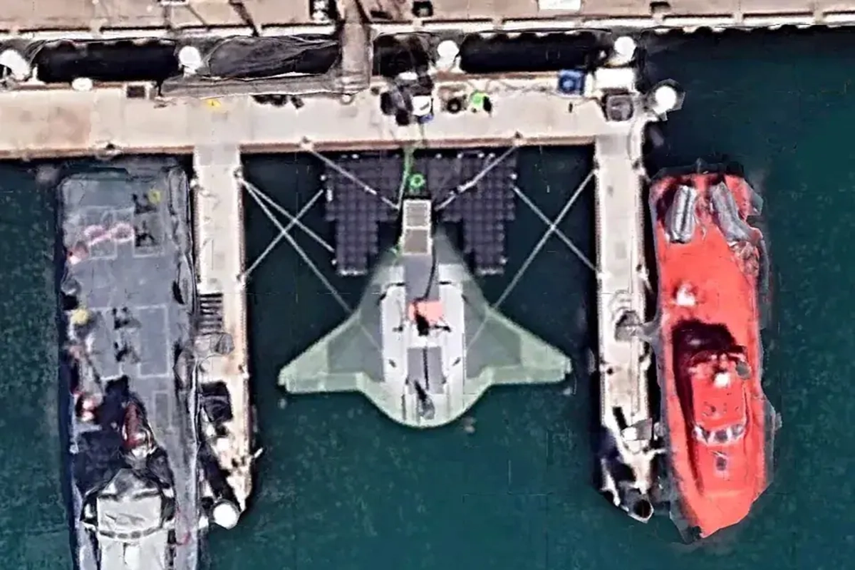
A top-secret prototype of a US military unmanned submarine called the Manta Ray was spotted by Google Maps users and remains available for viewing. Satellite photos show a ship that looks like a sci-fi starship docked at the Port Washington Naval Base in California, its futuristic shape hard to miss in the location.
The autonomous vessel was named after a sea creature because of its similar shape and ability to stay deep underwater while operating in low power mode. The Manta Ray, created by Northrop Grumman as part of the US Navy’s long-range underwater weapon project, is a sophisticated underwater drone capable of staying awake on the seabed for an extremely long time without refueling. It uses “effective gliding” underwater
“Our successful full-scale test of the Manta Ray confirms the vehicle’s readiness for real-world operations. … The ship is designed with multiple payload bays of different sizes and types, enabling it to perform a variety of naval missions,” Dr. Kyle Werner, Manta Ray program manager at DARPA, wrote in a press release.
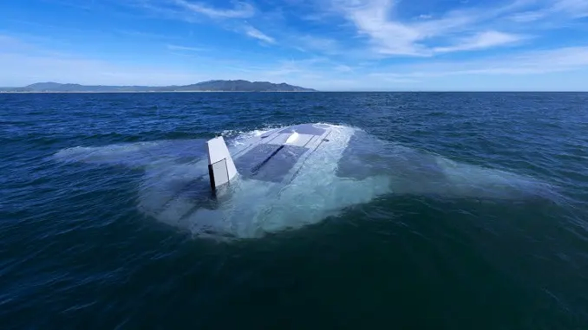
The modular design allows Manta Ray to be disassembled and transported in conventional containers, without additional port facilities. The US Navy tested the ship off the coast of Southern California for more than three months. Analysts suspect that the navy’s attempts to develop underwater drones are aimed at strategically countering Russian and Chinese submarine operations.