

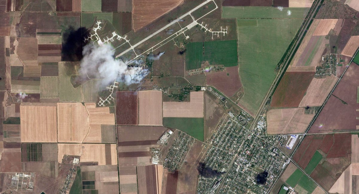
Satellite shows successful hits of the Ukrainian Armed Forces on Russians in Oktiabrske (photo)
The pictures show that yesterday’s “cotton” caused significant damage to the Russian occupiers
Satellite imagery from Planet Labs has been released to the public, confirming a successful strike on racist military targets in the temporarily occupied Oktyabrske in Crimea.
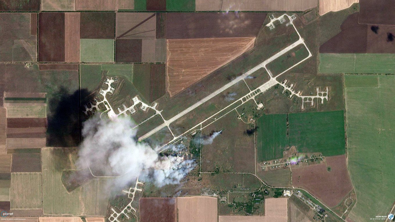
The images show not only that the fire broke out over a fairly large area after the oil depot was hit, but also traces of secondary detonation and scattering of ammunition as a result of a successful “arrival” at the BC storage sites located on the territory of the airfield in Oktyabrske, once the largest airfield of the Black Sea Fleet in the Soviet Union.
The images were made publicly available by OSINT analyst Hidenori Watanabe. The fact of the strike on the above-mentioned objects of the Russian occupiers was acknowledged by Stratcom in one of its messages on July 22, 2023.
As Defense Express previously reported, yesterday, July 22, the administration of the Russian occupiers in Crimea announced the fact of a drone strike on military facilities in Oktyabrske. At the same time, the Russians claimed that there was no damage, but at the same time they also announced the start of evacuation in the 5-kilometer zone from the “arrival” zone.

At that time, the invaders did not disclose the list of objects that were hit, but even then, local residents reported that the targets of the strike were the oil depot and ammunition depot at the airport in Oktyabrske.
The destruction was so “non-existent” that the occupation administration was even forced to stop railroad traffic throughout the temporarily occupied Crimea.
Since the affected oil depot is located close to the railway line from Oktyabrske to Hvardiyske, which then splits into two branches – to Yevpatoriya and Sevastopol – we are talking about most of the railway traffic on the temporarily occupied peninsula.
In turn, the airfield in Oktiabrske itself was abandoned in the 1990s, but shortly before the full-scale invasion of Ukraine, the Russian occupiers began to use this facility again, but as a huge field camp for their ground forces.
Google Earth images from February 2022 are publicly available, showing how many personnel in field tents, equipment in parking lots, and possibly ammunition have been accumulated by the Russian army in preparation for a full-scale war against our country.
