


The Ministry of Defense of the Russian Federation showed its retreat and the collapse of the front in the Kherson region
And also drew a new line of defense in Kharkiv Oblast
The so-called Ministry of Defense of the Russian Federation does not mention the offensive of the Armed Forces at all, but simply ‘redrawn’ the maps and pretended that it happened.
In the next issue of ‘Smihopanorama’, reports from the so-called Ministry of Defense of the Russian Federation recognized the rather difficult situation for the Russian army in the Kherson Region.
Despite the fact that in the speech itself, the lieutenant general of the Russian army, Konashenkov, did not say a single word, neither about ‘alignment of the front’ nor about ‘forced regrouping’, maps with the state of the front according to the Kremlin’s version were traditionally displayed behind his back.
And if you simply compare the map from the Ministry of Defense of the Russian Federation for October 3 and 4, they show a simply ‘magical picture’.
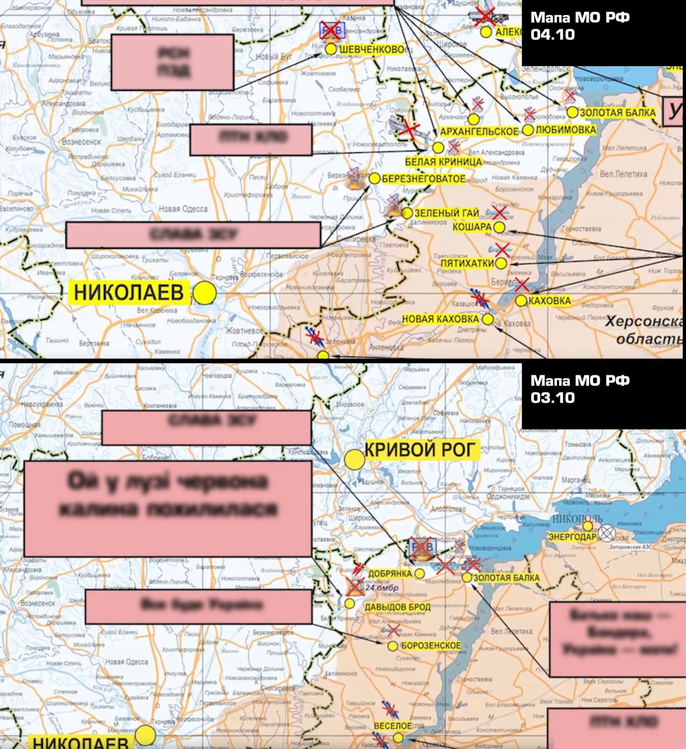
In particular, as of today, the enemy believes that the front line on the northern face of the bridgehead runs along the line Davidiv Brid – Nova Kamianka – Dudchany, in addition, the ZSU bridgehead is drawn in the area of the settlement of Zeleny Gay. And it even surpasses data from some Ukrainian unofficial sources.
With regard to Kharkiv Oblast, the Ministry of Defense of the Russian Federation simply ‘redrawn’ the map and pretended that it had always been like that.
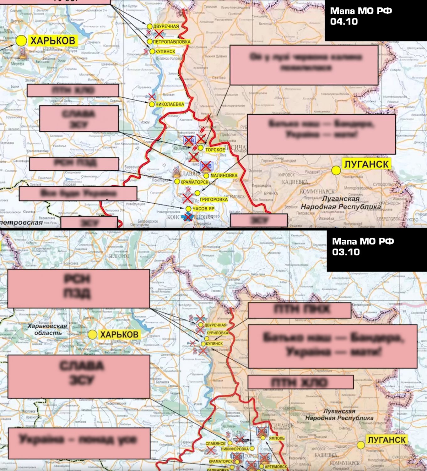
The command of the occupying forces left only a small patch in the area behind the settlement of Dvorichna in the status of ‘under the control’ of the Russian army in the Kharkiv region itself, and the current front ‘draws’ along the administrative border between the Kharkiv and Luhansk regions.