

ICEYE’s ‘People’s Satellite’ will remain fully owned by Ukraine until the end of its operation
The recent announcement by the Serhiy Prytula Foundation about the conclusion of an agreement with ICEYE with the purchase of a separate SAR satellite and access to the Finnish operator’s entire database of images expectedly caused a lively discussion in society. And now the company EOS Data Analytics (the founder and CEO is Maksym Polyakov), which contributed to the implementation of the project together with Serhii Prytula, shared details about the agreement, according to which the Ukrainian side receives both the satellite and access to the database of the constellation of satellites.
What is a satellite for Ukraine and the Armed Forces of Ukraine?
Unlike an optical satellite, which can only work during the day and in clear skies, a SAR satellite works in the microwave range (SAR) and acts like a lantern — it “illuminates” the earth’s surface with its own radio waves. The principle of SAR is based on the technology of two- and three-dimensional mapping of the landscape using the radiation and reception of radio signals reflected from the Earth.
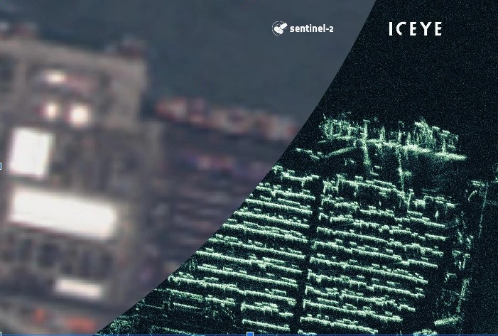
During the movement of the satellite in orbit, the radio waves reflected from the Earth’s surface in real time arrive at the receiving antenna, are recorded and compared with each other, and then transformed into a visual image with the help of software. Depending on the surface material, objects will reflect the same radio wave differently. Due to this difference, certain objects in the pictures appear brighter and others appear darker.
“The agreement between ICEYE and the Serhiy Prytula Charitable Foundation is an important step for strengthening Ukraine’s space capabilities.
First, only a limited number of countries have SAR satellites at their disposal, thanks to which Ukraine gains a competitive advantage in receiving data. Ukraine will receive them in a mode close to real time, thanks to which the time from ordering to receiving data will be reduced to hours.
Secondly, the satellite is already in orbit, that is, there is no need to wait for its launch, and the images are immediately analyzed and used as intended.
Third, Ukraine will receive images as long as the satellite continues to operate,” – Nick Kowalsky, Head of EOS SAR at EOS Data Analytics
Owning the ICEYE satellite allows Ukraine to receive exclusive images continuously, guaranteed and 24/7 under any weather conditions, despite rain, snow, fog, smog and dust, day and night. These pictures will help the high command with operational planning of military operations of demilitarization and deoccupation of the territory of Ukraine from the Russian occupiers.
Is it buying or renting?
According to the agreement, the Ukrainian side receives both the satellite and access to the database of the constellation of satellites. When the paid period of access to the database expires, this satellite remains in full ownership of Ukraine – until the end of its functionality in orbit.
The agreement provides for further re-registration of the satellite in the relevant registers in Ukraine. This is a legal procedure, and it does not happen instantly – it will take some time because the re-registration must be carried out in compliance with the necessary regulations, changes to the registers, etc.
The owner of the satellite is Ukraine, and it is the Ukrainian side that determines what and when it shoots, as well as in what format and spectrum the data will be received. That is, no one apart from Ukraine, which fully owns the satellite, will be able to manage and use the images of this satellite.
According to the agreement, the satellite is insured — if something happens to it before the end of the guaranteed period of operation, the selling company undertakes to provide the Ukrainian side with an identical satellite.
The main features and capabilities of the ICEYE satellite, which Ukraine received
Periodicity of flights — the satellite flies over the territory of Ukraine twice a day. Satellite images of the territory of Ukraine are received only by the Ukrainian side as the owner of the satellite; therefore, access is exclusive. When the satellite is not flying over the territory of Ukraine, the Ukrainian side can receive data thanks to access to the constellation of SAR satellites of the ICEYE company — it owns more than 18 satellites, which, flying over Ukraine, can collectively take about 36 images per day. In this way, continuous data acquisition is ensured.
The satellite operates in a sun-synchronous orbit. In 24 hours, the satellite makes 15 revolutions around the Earth, moving at a speed of 7.5 km per second. The satellite is located at an altitude of 500-600 km above the Earth’s surface.
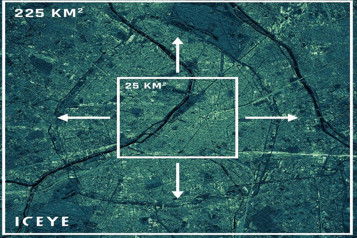
The resolution of satellite images is from 0.5 meters to 1 meter per pixel, depending on the area covered by the image. One picture can cover an area of up to 225 square kilometers.
Foreign partners do provide Ukraine with satellite images, but with a delay. Due to the fact that Ukraine bought the satellite, the process of data transfer from the moment of the image to the moment when it is received directly by military units is reduced to a few hours. In the conditions of war, the speed of obtaining information is a significant advantage that can determine the course of the war.
So, taking into account all of the above, there are currently no questions regarding the purchase of the ICEYE SAR satellite, which cannot be said about the Sich-2-1 (“Sich-2-30”) satellite and the activities of the Space Agency of Ukraine under the leadership of Volodymyr Taftai.