

Google to use artificial intelligence and satellite imagery to monitor methane leaks
The company cooperates with the Environmental Protection Fund to help fight climate change.
While carbon dioxide gets the lion’s share of attention when it comes to global warming, there are other factors at play as well. According to the International Energy Agency, methane is responsible for about 30 percent of the global temperature increase since the Industrial Revolution. The energy sector accounts for about 40 percent of methane emissions from human activity. Identifying and mitigating these emissions is one of the most important measures we can take in the short term to combat climate change.
To this end, Google and the Environmental Defense Fund (EDF) have teamed up again to address this issue. They have previously mapped methane leaks in large cities using sensors on Street View cars. This time, they are using a combination of satellite imagery and artificial intelligence.
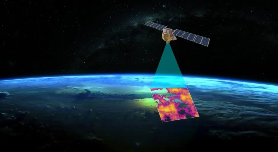
EDF and its partners have developed a satellite to be launched by a SpaceX Falcon 9 rocket in early March. While there are other satellite monitoring programs, MethaneSAT will provide the most comprehensive picture of methane emissions on the planet.
The satellite will orbit the Earth 15 times a day at an altitude of more than 350 miles and will focus on measuring methane levels in the largest oil and gas producing regions. It will be able to capture both large emissions from a single source and smaller methane sources spread over a larger area.
EDF and its partners have developed algorithms based on Google’s cloud technology to calculate emissions at specific locations and track them over time. Artificial intelligence will also be used to identify oil and gas infrastructure such as storage containers and pumping stations, similar to how Google uses AI to detect sidewalks, road signs, and road names in satellite imagery for Maps.
Combining the methane map with the oil and gas infrastructure map is expected to provide a clearer picture of where emissions are coming from. This will provide energy companies with practical information to help them stop leaks.
The results of the project will be available to the public on the satellite’s website and in Google Earth Engine later this year. “By making MethaneSAT datasets available on Earth Engine, which has more than 100,000 monthly active users, users can more easily identify trends and understand the relationship between human activity and environmental impact,” Yael Maguire, Google vice president and general manager of Geo Developer and Sustainability, wrote in a blog post. Earth Engine users will be able to compare methane data with other maps, such as maps of forests, regional borders, and water resources. They will also be able to view methane emissions over time.