

Earthquake in Japan on January 1 displaced the country’s coastline by almost 250 meters – satellite images
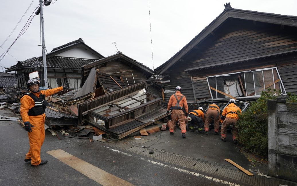
On January 1, a powerful earthquake with a magnitude of 7.6 occurred in Japan, which led to significant changes in the coastline of the Noto Peninsula. Recorded satellite images show that the earthquake caused the seabed to rise, causing the coastline to recede by as much as 250 meters, which is more than two American football fields, Space.com reports.
The earthquake that struck Japan’s Noto peninsula on Monday was so strong that the coastline has moved up to 250 meters offshore due to significant land uplift. pic.twitter.com/XpxBMLRTUU
— Nahel Belgherze (@WxNB_) January 4, 2024
Satellite images shared by Nahel Belgherze on X (formerly Twitter) show newly formed beaches where the sea floor has risen above the water. The photos captured the changes in the coastline after the earthquake and tsunami subsided, leaving some ports completely dry and inaccessible to boats.
“The earthquake that struck Japan’s Noto Peninsula on Monday was so strong that the coastline shifted 250 meters into the open sea due to significant ground rise. ” – wrote Nahel Belgherze.
Researchers from the Earthquake Research Institute at the University of Tokyo have found evidence of changes in ground level in the northwest of the Noto Peninsula in 10 locations. According to them, the coastal rise was most pronounced north of Kaiso and decreased southward to Akasaki.
The Akasaki port area also experienced a tsunami of almost 4.2 meters in height, as evidenced by water marks on the walls of buildings. The ALOS-2 satellite of the Japan Aerospace Exploration Agency (JAXA) also recorded these changes.
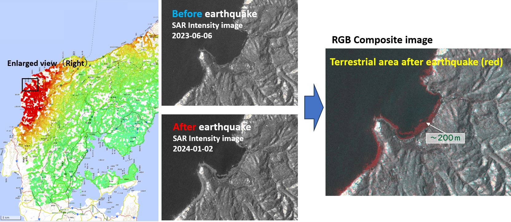
The satellite imagery compares the coast before and after the June 2023 earthquake, showing how the shoreline has receded into the sea in several locations, including Nafune Port, Wajima City, and Minazuki Bay.
Despite the significant changes revealed by satellite imagery, research along the coast continues.